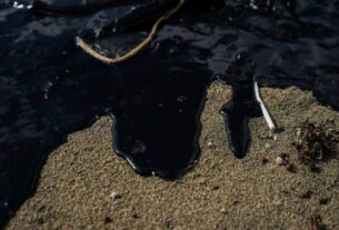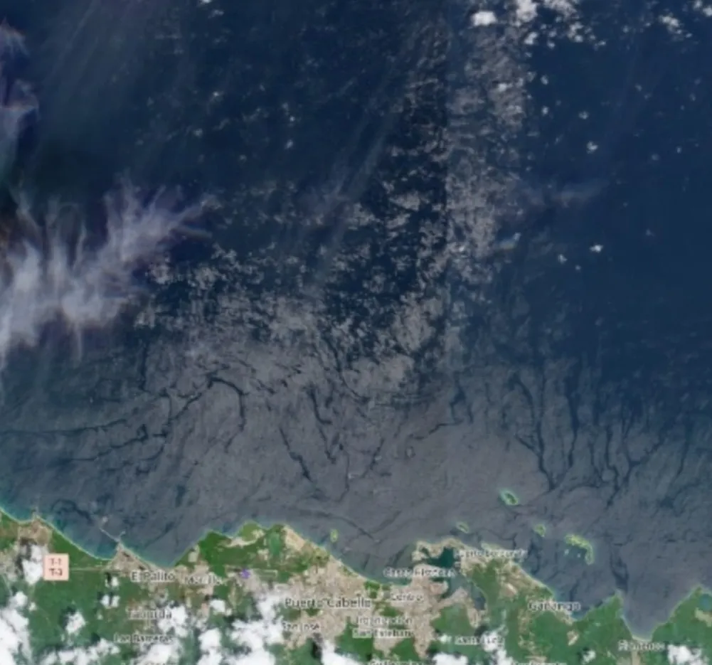
The Daily Journal.— An analysis of satellite imagery conducted by the Venezuelan-German Institute of Applied Ecological Sciences (IVACEA) detected an extensive anomaly consistent with hydrocarbon contamination in Golfo Triste, off Venezuela’s north-central coast. It warned of its potential impact on areas of Morrocoy National Park.
The study, based on imagery from the European Space Agency’s (ESA) Sentinel-1 and Sentinel-2 satellites, identified a continuous hydrocarbon film across an area stretching from Ocumare de la Costa to southern areas of Morrocoy, including Boca Grande, Bajo Caimán and Cayo Ánimas.
According to the report, an analysis of the images over time identified continuous discharges between August and September 2026. IVACEA links the detected signals to possible operational discharges from industrial facilities in the area, including the El Palito Refinery, the Puerto Cabello port area, and a thermoelectric power plant.
The institute said it delineated a 47.56-square-kilometer Area of Interest concentrated around the region’s industrial hub. Researchers have monitored the area through time-series satellite imagery since 2023, covering different climatic cycles.
An episode detected in September
Synthetic aperture radar (SAR) analysis from the Sentinel-1 satellite identified September 11 as the point when the anomaly reached its greatest intensity.
According to the report, researchers recorded a significant decrease in water surface roughness on that date, a variable used to identify hydrocarbon films on the sea surface.
The study found that the deviation reached 46.51% compared with the so-called Bonaire Golden Standard (BGS), a benchmark IVACEA developed using waters considered pristine in the southern Caribbean.
Based on the parameters analyzed, the institute estimated a hydrocarbon film 889.3 nanometers thick, equivalent, according to its calculations, to approximately 266.04 barrels of oil, or 42.30 cubic meters, confined to the industrial area under analysis.
The report also warns that as of September 28, the imagery continued to show signals consistent with an active discharge, which, according to IVACEA, would indicate that the source of the contamination remained uncontrolled.
Analysis rules out natural causes
The study used spectral indices obtained through Sentinel-2 optical sensors to determine the nature of the anomaly. According to IVACEA, the results allowed researchers to rule out natural explanations such as algal blooms or high concentrations of suspended sediment.
The institute attributes the observed signals to a combination of operational discharges, untreated effluents, accumulated runoff, and possible ballast discharges from oil tankers in the industrial anchorage and transit area.
IVACEA’s technical analysis supports these conclusions. The material provided does not include responses from the facilities or companies mentioned, nor does it include independent verification of the discharge sources.
History of spills
The report places the area within a corridor that, according to its records, has a history of large-scale pollution events. IVACEA states that between 2020 and 2024, three spills exceeding 50,000 barrels occurred in the area under study.
According to the institute, two of those incidents had visible impacts on areas of Morrocoy National Park. Another moved eastward and reached areas of San Esteban National Park and parts of the Aragua coastline.
The study maintains that the Morrocoy areas included in the analysis had already shown persistent signs of contamination in previous assessments, with micrometer-scale hydrocarbon films present.
Environmental and economic risk
The research warns that the contamination represents not only an ecological risk to marine and coastal ecosystems, but also a potential economic problem for a region whose natural heritage carries significant tourism and environmental value.
The report argues that persistent pollution incidents could increase the regulatory, reputational, and environmental risks associated with industrial and extractive activities along Venezuela’s coast.
IVACEA links this situation to the challenge of attracting investment and expanding productive activity without damaging strategic environmental assets. In particular, it warns that any strategy to expand industrial and oil activities must incorporate environmental management and controls on emissions and discharges.
The analysis concludes that satellite monitoring makes it possible to track the evolution of these anomalies even in areas without continuous surface-level environmental monitoring. It stresses the need to maintain surveillance over Golfo Triste and protected areas that may be exposed to new pollution events.