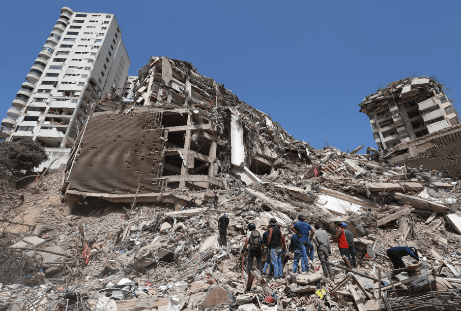
The United Nations Development Programme (UNDP) estimated that the two earthquakes recorded on June 24 in north-central Venezuela caused approximately $6.7 billion in direct material damage—an amount equivalent to nearly 6% of the country’s Gross Domestic Product (GDP)—according to a preliminary technical report based on satellite imagery.
The evaluation was developed using the Rapid Digital Analysis (RAPIDA), a methodology that combines artificial intelligence and Geographic Information Systems (GIS) to measure the initial impact of natural disasters on housing, infrastructure, and economic assets.
“Preliminary estimates indicate direct physical damage of 6.7 billion United States dollars (USD), equivalent to around 6% of GDP, based on a satellite assessment using the Rapid Digital Analysis (RAPIDA),” the agency stated in its report.
According to the analysis, the immediate economic impact on housing and productive assets could range between $4.7 billion and $8.7 billion, depending on the degree of damage determined by the field assessments currently underway in the hardest-hit areas.
However, the UNDP warned that these figures represent only an initial approximation of material losses and do not reflect the total cost the country will face.
“This preliminary balance does not include damage to infrastructure, wider economic disruption, or long-term reconstruction costs,” the United Nations agency specified.
The organization explained that, based on comparable international experiences, the total economic impact of a disaster of this magnitude typically ranges between 1.5 and three times the value of direct physical damage, once lost productivity, disruption of essential services, and the investments required for reconstruction are factored in.
Exposed Population and Critical Zones
The assessment combined seismic models with demographic data to measure the scope of the 7.2 and 7.5 magnitude earthquakes. The UNDP calculated that around 1.7 million structures were located within the affected area, which encompassed Caracas and the states of La Guaira, Carabobo, Miranda, Yaracuy, and Aragua.
“The analysis concluded that around 8.6 million people were exposed to greater-than-moderate shaking in the northern part of the country, including approximately 2.1 million exposed to more intense shaking,” the technical report specified.
Furthermore, by monitoring the reduction in nighttime lighting, satellite data detected widespread power supply disruptions in areas of Caracas, Aragua, La Guaira, and Carabobo.
Resilience and Evidence-Based Reconstruction
The UNDP Resident Representative in Venezuela, Luis Francisco Thais, emphasized the importance of utilizing high-resolution technological resources during the first 72 hours of the crisis to optimize institutional decision-making and the deployment of humanitarian commissions.
“The speed and accuracy of initial assessments are essential for an effective response (…) Tools like RAPIDA help us make decisions faster and based on evidence to support the affected communities. At the same time, every crisis represents an opportunity to rethink development strategies by placing resilience at the center. This ensures that recovery not only restores what was lost but also builds a more sustainable future,” Thais argued.
The United Nations delegation confirmed that it will continue processing satellite imagery as atmospheric conditions allow for clearer captures, aiming to further assist local authorities in quantifying casualties, structural damage, and displaced population movements.